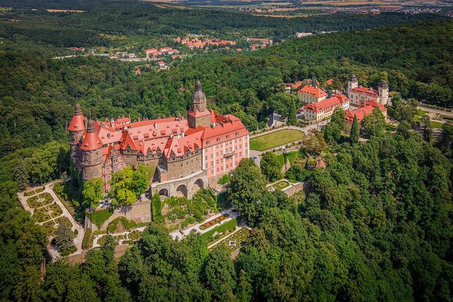
A free interactive atlas has begun charting the world’s fortified heritage, plotting more than 6,400 castles, fortresses and palaces across 138 countries on a single browsable map. The project was launched by a Norwegian developer working under a pseudonym, and shows what a combination of AI, open data and programming skill can now achieve great results without institutional backing.
Castlemap, at thecastlemap.com, currently lists 2,922 castles, 1,290 fortresses, 951 palaces and châteaux, and 1,249 ruins, each pinned with a photograph, founding century and story. The total has climbed steadily since launch and rises with every refresh and we love every bit of it.
Its author works under the name Flightmussy, which he (or she) has explained is a private joke rather than a company. Castlemap is one of a family of atlases Flightmussy has built, alongside TrainRouter, which traces passenger rail routes across 120 countries, a Sunshine Atlas and a European beach map (not surprised a Norwegian comes up with these ideas), and Detourmap, a catalogue of nearly 115,000 places of interest.
One person, working in the open
Flightmussy is candid about the method: AI does much of the heavy lifting, and a human decides what ships. Writing about the rail atlas, (s)he set out the underlying principle, that the map is only the demonstration and the structured data behind it is the actual product.
Everything on the castle map is drawn from open sources: facts, coordinates and founding dates from Wikidata, photographs from Wikimedia Commons, descriptive text from Wikipedia, and the night basemap from OpenFreeMap and Natural Earth. The full dataset is free to download as GeoJSON and CSV under a CC0 licence and citable via DOI. There are no advertisements and no accounts.
That architecture solves a problem which has defeated other heritage databases. Corrections are made not on the site but at source, by improving a landmark’s Wikidata entry, after which the change appears at the next refresh and benefits every other project built on the same data.
The Wikimedia dependency
It introduces a dependency in return. The criteria for inclusion are documentary rather than physical: a landmark qualifies when it has coordinates in Wikidata, an article on Wikipedia and an image on Wikimedia Commons. Nothing in that test asks whether the building is still standing.
The consequence is a map that records where castles were as much as where they are. Sites long since demolished, burnt out or dismantled for their stone remain plotted, because someone made an entry on Wikipedia. The photograph requirement filters less than it appears, since Commons holds engravings, nineteenth-century views and images of empty ground where a keep once stood. The same mechanism applies to buildings that have changed. Where Commons holds only an older photograph, the map inherits it.
But none of this is a flaw in the engineering, and an atlas of former fortifications has a real value of its own. What it does mean is that the map should not be read as a visiting list without checking. For heritage foundations that have spent heavily on restoration, meanwhile, the incentive to refresh their Commons material has become a practical one. An outdated photograph no longer sits quietly in an archive. It propagates.
Limits of ranking
The atlas makes no claim to completeness, and says so plainly. Its author describes it as a curated selection rather than an inventory, noting that Germany alone is estimated to hold some 25,000 castle sites against the 351 French entries that currently lead his map. Density, he writes, is the story: Europe glows while most of the planet stays dark.
Sites are ordered by a ranking that blends Wikipedia coverage with readership, an approach that risks undervaluing countries whose heritage is documented in a single language. He or she has begun compensating for it. Japan’s 100 Famous Castles and its sequel list are admitted in full, regardless of how few Wikipedia editions cover each entry, and comparable national lists elsewhere are invited.
The creator is also visibly responsive. On mapping and technology forums (s)he has thanked contributors, added their suggested sites, and, after a run of critical comment, said the project will now receive full commitment. Given how much of Europe’s fortified heritage has never been findable in one place, that is very much worth encouraging.
Go look for yourself and enjoy at thecastlemap.com
Sources
Castlemap and how the map is made
TrainRouter, Sunshine Atlas and Detourmap
OpenStreetMap Community Forum, TrainRouter thread
DEV Community, “How I built an interactive atlas of 767 train routes”
Lemmy, Map Enthusiasts, operator post
Hacker News discussion
Boing Boing, interactive map of the world’s castles
Bright.nl, “Op pad: Deze website brengt indrukwekkend veel kastelen in kaart”, 26 July 2026